
Generates random tilings of the occupied sites in a phylospatial
object, for use as site_groups in ps_rand(). This is a wrapper around
nullcat::tile_groups() that extracts site coordinates from ps.
Arguments
- ps
A
phylospatialobject with spatial data.- spacing
The size of the tiles: the distance between the centers of neighboring hexagonal tiles, or on the sphere, the equivalent spacing for tiles of the same area. In meters if
pshas a coordinate reference system, otherwise in coordinate units. Either a single value or a vector ofnvalues (one per tiling). Supply eitherspacingorgroup_size.- n
Number of tilings to generate. For
ps_rand(), use one per randomization (n = n_rand).- group_size
Alternative to
spacing: the nominal number of sites per tile, ignoring edges and gaps (see details). Either a single value or a vector ofnvalues. Requires sites with areas (raster cells or polygons).
Value
An integer matrix with a row for every occupied site (in the order of
ps$occupied) and a column for every tiling, giving each site's tile, with
the tile spacing used as its "spacing" attribute.
Details
Supplying the result to ps_rand(site_groups = ...) gives a spatially
constrained null model: in each randomization, the community matrix is
randomized independently within each tile of a different, randomly placed
and oriented tiling, so taxa are only redistributed among nearby sites.
Across randomizations, two sites a distance d apart share a tile with a
probability that depends only on d: it falls from 1 at d = 0 to about 0.5
at d = 0.42 * spacing, and to 0 at about 1.15 * spacing in the plane or
1.3 * spacing on the sphere. See nullcat::tile_groups() for details.
Site coordinates are cell centers for raster data, or feature centroids for
sf data. If ps has a coordinate reference system, sites are projected to
longitude and latitude and tiled on the sphere, with spacing in meters, so
results don't depend on the map projection. Tiles on the sphere all have the
same area, but vary in shape between irregular hexagons and near-squares.
Without a coordinate reference system, sites are tiled with regular hexagons
in the plane, with spacing in coordinate units.
The scale of the tiling can be set either as a distance (spacing) or as a
nominal number of sites per tile (group_size). group_size is converted to
the spacing that gives tiles of group_size times the average area of the
occupied sites, i.e. the expected number of sites in a tile that lies wholly
within a fully occupied part of the study area. Note that this ties the
distance scale of the null model to the resolution of the data: the same
group_size covers a larger distance on a coarser grid. The spacing used is
returned as the "spacing" attribute of the result.
Sites near edges and gaps tend to fall in tiles with fewer sites than
group_size, and a site alone in its tile is not changed by fixed-margin
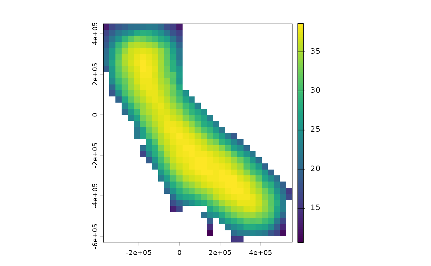
randomizations. Use ps_group_sizes() to map each site's realized average
pool size.
Examples
# \donttest{
if (requireNamespace("nullcat", quietly = TRUE)) {
ps <- moss()
tiles <- ps_tile_groups(ps, spacing = 200e3, n = 100)
terra::plot(ps_group_sizes(ps, tiles))
# tiles of about 40 sites each (away from edges and gaps)
tiles40 <- ps_tile_groups(ps, group_size = 40, n = 100)
attr(tiles40, "spacing") # in meters
}
 #> [1] 203885.5
# }