
Get example phylospatial data set based on a phylogeny and modeled distributions of 443 moss species
across California. This data set is a coarser version of data from Kling et al. (2024). It contains
occurrence probabilities, and is available in raster or polygon spatial formats. Companion layers giving
existing land protection and human population density on the same spatial grid are also available, for
use as init and cost inputs to conservation prioritization functions like ps_prioritize().
Source
Kling, Gonzalez-Ramirez, Carter, Borokini, and Mishler (2024) bioRxiv, https://doi.org/10.1101/2024.12.16.628580.
Protection: Kling, Mishler, Thornhill, Baldwin, and Ackerly (2019) Facets of phylodiversity: evolutionary diversification, divergence and survival as conservation targets. Philosophical Transactions of the Royal Society B 374: 20170397, https://doi.org/10.1098/rstb.2017.0397.
Population density: Center for International Earth Science Information Network (CIESIN), Columbia University (2018). Gridded Population of the World, Version 4 (GPWv4): Population Density, Revision 11. NASA Socioeconomic Data and Applications Center (SEDAC), https://doi.org/10.7927/H49C6VHW.
Arguments
- format
Either "raster" (default) or "polygon"
- data
Which data set to return. One of:
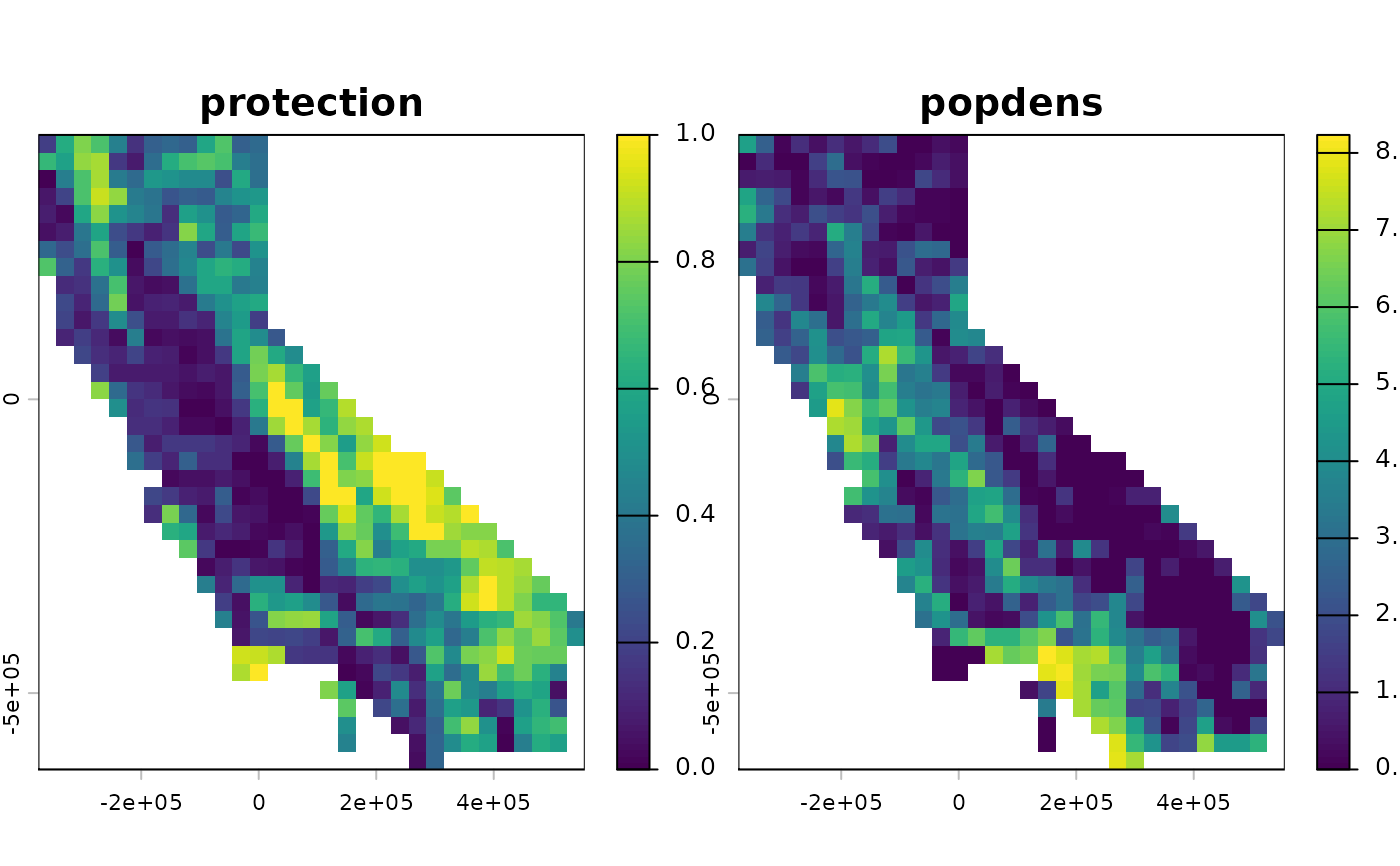
"phylospatial"(default): the moss spatial phylogenetic data set."protection": the existing protection level of each grid cell, ranging from 0 (unprotected) to 1 (fully protected), based on the California Protected Areas Database (CPAD) and California Conservation Easement Database (CCED) as compiled by Kling et al. (2019). Values above 0.95 are set to 1."popdens": mean human population density in each grid cell, in persons per square kilometer, from Gridded Population of the World v4 (2020). Because these values span several orders of magnitude and include zeros, they will usually need to be transformed before use as a prioritizationcost.
Value
If data = "phylospatial", a phylospatial object. Otherwise, a SpatRaster (if format = "raster")
or sf data frame (if format = "polygon") with one variable, named after data, covering the same grid as
the moss data set, with NA values for sites containing no moss taxa.
Examples
# \donttest{
moss()
#> `phylospatial` object
#> - 884 lineages across 527 occupied sites (1116 total)
#> - community data type: probability
#> - branch length rescaling: sum1
#> - site weights: equal
#> - spatial data class: SpatRaster
#> - dissimilarity data: none
# companion layers for conservation prioritization
protection <- moss(data = "protection")
popdens <- moss(data = "popdens")
terra::plot(c(protection, log1p(popdens)))
 # }